When Jamaica was first colonised by the Spanish in the early 16th century, its administration looked very different from the orderly parishes we know today. The island, known as Xaymaca by the Taíno, was under Spanish control from 1494 until 1655, when it was captured by the British. This early period laid the foundation for the island’s administrative structures, which would evolve significantly under English influence.
Spanish Rule: Loose Administration and Regional Divisions
Spain’s interest in Jamaica began with Christopher Columbus’s arrival in 1494, but it wasn’t until 1509 that the Spanish began formal settlement. The capital was initially established at Seville la Nueva or New Seville on the north coast in 1510, before being moved to St. Jago de la Vega (now Spanish Town) in 1535 due to health concerns and better defensibility.
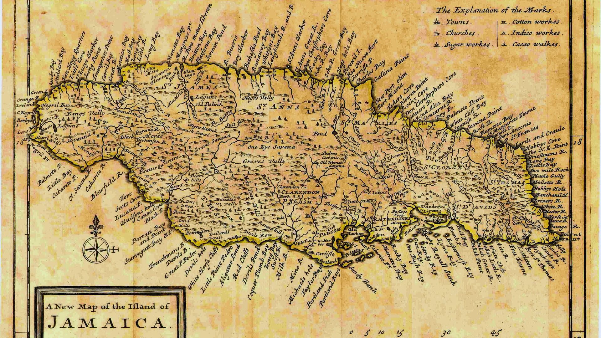
Under Spanish rule, Jamaica was sparsely populated and never developed into a major colony like Cuba or Hispaniola. The Spanish also failed to implement a robust administrative structure. Instead, the island was divided into ten loosely defined districts that reflected settlements and landholdings rather than formal governance. These districts included: Port Moranto, Morant, Yealoth (Yallahs), Legene, Saint Angelo Delvega (St Jago de la Vega), Between Black River and Bower Savanna, The Angles Quarters, Seven Plantations, Macaria and Qaathebeca, Quanaboa (Guanaboa Vale) and Quardalena, and Upon Point Gangway (Port Royal). These divisions were more indicative of major estates and geographic areas than any structured political or administrative system.
Several place names from this era—such as Yallahs, Liguanea, and Guanaboa—reflect a blend of Spanish and Taíno influences, and many survive in modern Jamaica.
The British Take Over: 1655 and the Seeds of Change
In 1655, a British expedition led by Admiral William Penn and General Robert Venables captured Jamaica from the Spanish during the Anglo-Spanish War. While many of the Spanish settlers fled to Cuba, the British inherited a colony with minimal infrastructure and a small European population.
Determined to make Jamaica a successful colonial holding, the British introduced more structured systems of governance. One of their first acts was to divide the island into administrative units, gradually moving from military rule to civil administration.
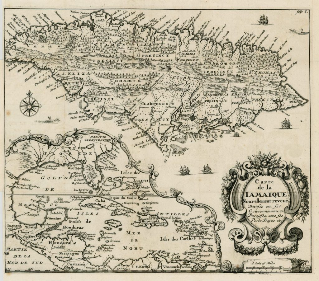
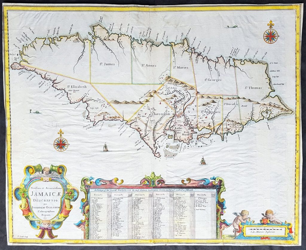
By the early 1660s, under the governorship of Sir Thomas Modyford (1664–1671), Jamaica’s first formal parishes were established. These were both ecclesiastical and civil divisions, reflecting the close relationship between church and state in English governance. Initially, seven parishes were created in the more settled south and central parts of the island:
- Clarendon
- St. John
- St. Andrew (then called Liguanea)
- St. Catherine
- Port Royal
- St. David
- St. Thomas (later St. Thomas-in-the-East)
Parishes were used to organise local governance, tax collection, and church activities. Over the following decades, as the British expanded their control across the island, more parishes were added. By 1675, Jamaica had 15 parishes, covering most of the island. Eight additional parishes had been established, namely: Vere (separated from Clarendon in 1673), St. George, St. Thomas in the Vale, St. Dorothy, St. Ann, St. Elizabeth, St. James, and St. Mary. The boundaries of these parishes were formally confirmed by An Act for Regulating the Parishes in 1677.
Local Administration
Under British colonial rule, local administration in Jamaica was organised at the parish level, forming the foundation of civil governance across the island. Each parish was overseen by a vestry, an elected body made up of local freeholders responsible for managing parish affairs. Supporting the vestry were churchwardens, who handled church-related matters and community welfare. The parish’s chief magistrate, known as the custos rotulorum, presided over the vestry and acted as the Crown’s senior local representative.
Together, these officials managed a range of responsibilities, including tax collection, maintenance of roads and bridges, upkeep of public buildings, and care for the poor. This system allowed for local decision-making and community-level governance, embedding British administrative practices into Jamaica’s colonial society.
From Seven to Twenty-Two to Fourteen
As British settlement spread and the island’s economy—especially sugar plantations—grew, so did the number of administrative divisions. The parish system expanded significantly over the next two centuries:
- 1693: Kingston separated from St. Andrew, becoming its own parish.
- 1703: Westmoreland formed from the western part of St. Elizabeth.
- 1723: Portland created from parts of St. George and St. Thomas-in-the-East; Hanover split from Westmoreland.
- 1770: Trelawny formed from parts of St. James and St. Ann.
- 1814: Manchester created from sections of Clarendon, Vere, and St. Elizabeth.
- 1841: Metcalfe Parish established from parts of St. George and St. Mary.
By 1841, the island had reached its peak number of 22 parishes.
However, by the mid-19th century, the colonial government saw the need to streamline local governance. On 23 April 1867, the Law to Reduce the Number of Parishes was passed, reducing the number from 22 to 14. Several smaller or less economically viable parishes were absorbed into larger ones:
- Vere was merged into Clarendon
- St. Dorothy, St. John, and St. Thomas-in-the-Vale were merged into St. Catherine
- St. David was absorbed by St. Thomas
- St. George merged into Portland
- Metcalfe became part of St. Mary
- Port Royal was divided between Kingston and St. Andrew
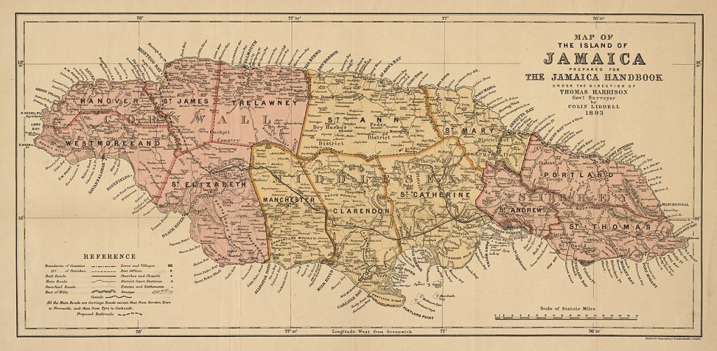
This consolidation created the 14 parishes that exist today, which were further grouped into three counties—Surrey, Middlesex, and Cornwall—for administrative and judicial purposes.
Parishes and British Colonial Identity
The names of Jamaica’s parishes offer insight into colonial identity and power. Many were named after British monarchs, governors, their family members, or places in England. For instance:
- St. Catherine was named for Queen Catherine of Braganza, wife of Charles II.
- Clarendon was named after the Lord Chancellor, Edward Hyde, Earl of Clarendon.
- St. Elizabeth honoured the wife of Governor Thomas Modyford.
By the mid-18th century, Jamaica’s parishes and counties were fully established, forming a framework for local governance, taxation, and church affairs that shaped the colony well into the 20th century.
Complex & Layered Colonial Legacy
Though the Spanish left behind relatively few administrative structures, their early settlements and place names remain etched into the island’s geography. The British, on the other hand, transformed Jamaica’s governance entirely—introducing systems that formed the basis for the modern state. The arrangement and governance of Jamaica’s parishes, formalised under British rule, continues to serve as the foundation of local administration in Jamaica, with boundaries, names, and county affiliations rooted in a complex and layered colonial past.